
|
Huang Shang, Wang Chih-Yuan |
T'ien wên t'u, La mappa delle stelle di Suchow, Cina 1193-1247
|
Huang Shang
Wang Chih-Yuan
T'ien wên t'u, La mappa delle stelle di Suchow, Cina 1193-1247

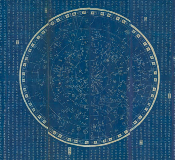
Il planisfero celeste che presento in questa pagina è una rara copia di una stampa per "rabbing" su carta realizzata in Cina tra il 1890 ed il 1910 che riproduce la volta stellata incisa sulla pietra originale nel 1247 da Wang Chih-Yuan ma preparata, compreso il testo esplicativo, dal geografo e tutore imperiale Huang Shang nel 1193.
La tavola su carta, cm 183 per 100, è attualmente messa in vendita da
Paulus Swaen Old Maps che la presenta con una pagina che di seguito riproduco:
https://www.swaen.com/antique-map-of.php?id=27137
Description :
The chart was engraved on stone in 1247 by Wang Zhiyuan, but it is based upon an earlier drawing by Huang Shang, made c. 1190-1193 at the beginning of Shaoxi in the Southern Song Dynasty, while he was entrusted by the emperor as his son's tutor.
The caption at the top consists of three old=style ideographs. Beginning at the
right they are: t'ien, "heaven"; wên "literary" or "scolarly"; and t'u "map",
"chart" or "plan". Herbert A. Giles defies T'ien wên t'u as "A map of the stars".

The stars and lines appear white on a black background. According to Ian Ridpath:
"The planisphere depicts the sky from the north celestial pole to 55 degrees
south. Radiating lines, like irregular spokes, demarcate the 28 xiu (akin to the
Western Zodiac system). These lines extend from the southern horizon (the rim of
the chart) to a circle roughly 35 degrees from the north celestial pole, within
this circle lie the circumpolar constellations, i.e. those that never set as
seen from the latitude of observation.


Cerchio delle costellazioni circumpolari a 35° di declinazione. Il luogo di osservazione che genera la mappa è pertanto a 55° di latitudine Nord

Si riconosce il Grande Carro nell'Orsa Maggiore

da Ian Ridpath, Charting the Chinese sky:
Le 28 mansioni lunari confinate da raggi che
partendo dal cerchio esterno di declinazione posto a - 55° raggiungono
il cerchio delle costellazioni circumpolari

La mansione numero 1, Jiao, le altre si susseguono in senso orario


Eclittica ed equatore si incontrano all'equinozio autunnale e primaverile nei nodi omega e gamma
Two intersecting circles represent the celestial equator and ecliptic, which the
Chinese called the Red Road and the Yellow Road respectively. An irregular band
running across the chart outlines the Milky Way, called the River of heaven –
even the dividing rift through Cygnus can be made out. All 1464 stars from Chen
Zhuo's catalogue are supposedly included (an inscription on the planisphere
tallies the total as 1565, but this is clearly an ancient Chinese typographical
error [and a recent count suggests that the stele depicts a total of 1436 stars]),
not all of the stars show up on the rubbing, however."
The planisphere was reproduced and discussed in a rare book entitled The Soochow
Astronomical Chart, by W. Carl Rufus and Hsing-Chih Tien, University of Michigan
Press, Ann Arbor, Michigan, USA, 1945. A copy of this book is in the
Foundation’s library. In 1945, the stela was still located at Suzhou (‘Soochow’
in the old spelling) and had not yet been moved to Purple Mountain. However, the
stela continues to be known as the ‘Suzhou’ planisphere, or astronomical chart.
It was Joseph Needham who classified the chart as a ‘planisphere’, since which
time that term has been adopted for it. Needham used the older spelling of
Suchow, which is however newer than the spelling ‘Soochow’ used by Rufus and
Tien. Suzhou is the modern spelling using the Mainland Chinese Pinyin system of
transliteration.
Rufus and Tien in their 1945 book published an English translation of the full
text inscribed on the stela, together with an extensive astronomical analysis.
Joseph Needham’s discussion of the planisphere is to be found in Volume 3 of
Science and Civilisation in China (Cambridge University Press, 1959), pages
278-9, 281, and 550. The main discussion is found in the Astronomy section of
that volume, and a reproduction of the planisphere itself, but without its
accompanying text, appears as Figure 106 on page 280. (Needham took his
illustration from a reproduction of the illustration appearing in Rufus and
Tien’s book, so it is less clear than theirs.)The text below the chart gives
instruction to the new emperor with information on the birth of the cosmos, the
size and composition of both the heavens and the earth, the poles, the celestial
equator (the Red Road) and the ecliptic (the Yellow Road), the sun, the moon,
and the moon's path (the White Road), the fixed stars, the planets, the Milky
Way (or the River of heaven), the twelve branches, the twelve positions, and the
kingdoms and regions.
The main text on the stela commences in this manner:
‘Before the Great Absolute had unfolded itself the three primal essences,
Heaven, Earth, and Man, were involved within it. This was termed original chaos
because the intermingled essences had not yet separated. When the Great Absolute
unfolded, the light and pure formed Heaven, the heavy and impure formed Earth,
and the mingled pure and impure formed Man. The light and pure constitute
spirit, the heavy and impure constitute body, and the union of body and spirit
constitute man.’
%20copia.jpg)
The lengthy and detailed text preserved on the stela is an extraordinary major
work of Chinese philosophy and early science.
It is difficult to ascribe a precise date to the rubbing, there were periods in
the seventeenth century where rubbing's were popular with the early Jesuits in
the Kangxi court, and again in the eighteenth century in the Kangxi through
early Qianlong courts, but equally in the late nineteenth and early twentieth
centuries during European archaeological explorations of the region.
The last rubbing's were made in the 1990s and the Chinese Government at that
time authorized ten rubbings to be made from the carved stone, nine went to
Chinese museums and institutions, and one is now in The History of Chinese
Science and Culture Foundation.
Whilst several institutions, such as the Suzhou Museum of Inscribed Steles and
the national Library of China in Beijing, and Max Planck Institute for the
History of Science in Berlin hold similar early rubbing's, this particular
rubbing is very rare on the market, currently one other example is for sale with
Daniel Crouch Rare books.
See more about stone rubbing at

www.lib.berkeley.edu/EAL/stone/rubbings.html
Reference : Rufus, W.C. and Hsing-Chih Tien, 'The
Shoochow Astronomical Chart', Ann Arbor, University of
Michigan Press, 1945; Ridpath, Ian, 'Charting the Chinese Sky
(www.ianridpath.com/startales/chinese.htm)'
about
Condition :
Ink rubbing taken from a stele. A rubbing from ca. 1890/1910 of a thirteenth-century astronomical stele from Wen Miao Temple (Confucian Temple of Literati) Suzhou, Kiangsu, China, prepared for the instruction of a future emperor. The stele survives in the Suzhou Museum of Inscribed Steles.
With the usual worm holes, filled in and recently mounted as a hanging scroll
and actually ready to hang.
La Tavola

Note Bibliografiche
Il planisfero di Suchow è stato fatto oggetto di studio nel saggio di W. Carl Rufus e Hsing-Chih Tien, The Soochow Astronomical Chart, University of Michigan Press, Ann Arbor, Michigan, USA, 1945 che può essere letto alla pagina che indico per cortesia di Hathi Trust Digital Library:
https://babel.hathitrust.org/cgi/pt?id=mdp.39015071688480
Informazioni sul planisfero e sulla rappresentazione del cielo nella cultura antica cinese possono essere lette in questi siti
dedicati alla cartografia celeste:
Ian Ridpath, Charting the Chinese sky

http://www.ianridpath.com/startales/chinese.htm
e
a cura di IDP, International Dunhuang Project
History of Astronomy in China
http://idp.bl.uk/education/astronomy/history.html
La stessa carta celeste, con pochissime differenze, è rappresentata in
Yunyou Sanren 雲遊散人 e Huang Shang 黃裳
Huntian yitong xingxiang quantu 渾天壹統星象全圖 [Complete Celestial Chart] , China 1822
http://www.atlascoelestis.com/Yunyou%201822.htm
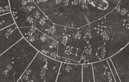
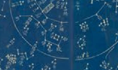
La zona del Grande Carro nell'Orsa Maggiore nelle due mappe
La tavola viene esaminata anche nel monumentale lavoro di
Joserph Needham, Scienza e civiltà in Cina, Volume 3*, La matematica e le scienze del cielo e della Terra, I. Matematica e astronomia, pag. 340 ss, Giulio Einaudi Editore, Torino 1985
Puoi leggere anche il seguente articolo dedicato alla prima mappa celeste cinese:
The Dunhuang Chinese Sky, VII Sec. d. C., Cina
(Journal of Astronomical History and Heritage 12:39-59,2009)
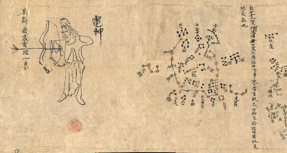
http://www.atlascoelestis.com/Dunhuang%20VII%20sec%20base.htm
e
Claudio Filippo Grimaldi, Min Mingwo Dexian
Fang-sing-tou-kiai: Explication de les Tables de toutes les étoiles, Pechino 1711
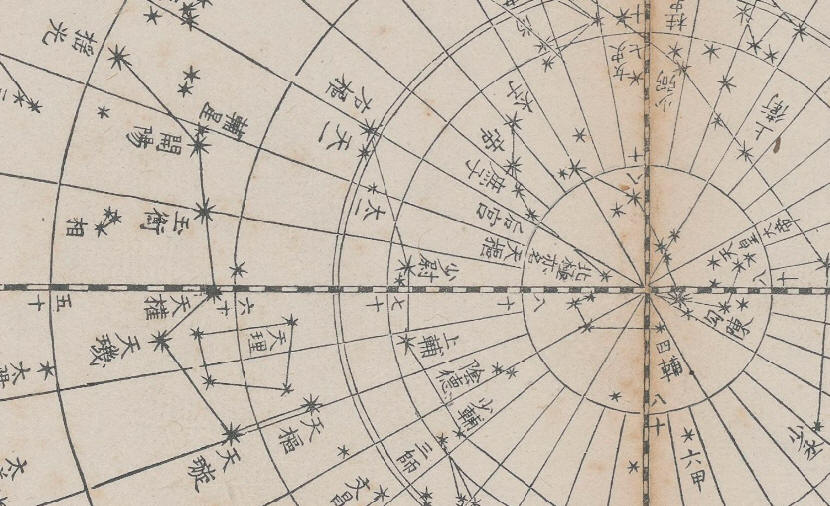
http://www.atlascoelestis.com/grimaldi%201711.htm
e
Tae-Tsen-Hsun
Carta celeste e del Sistema Solare, Cina 1723 circa
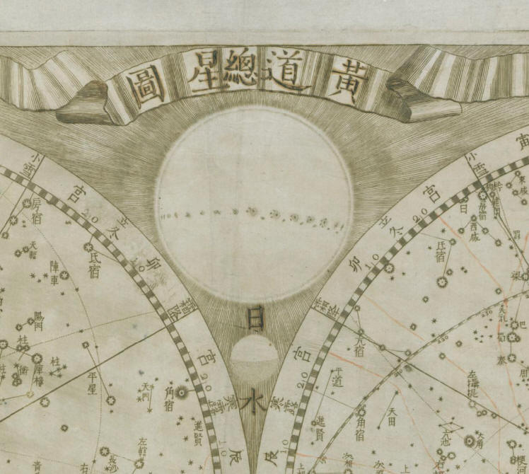
http://www.atlascoelestis.com/Thetsen%201723.htm
e
Gustav Schlegel
Uranographie Chinoise, Atlas Céleste Chinois et Grec d’après le Tien-Youen Li-Li, La Haye e Leyde 1875
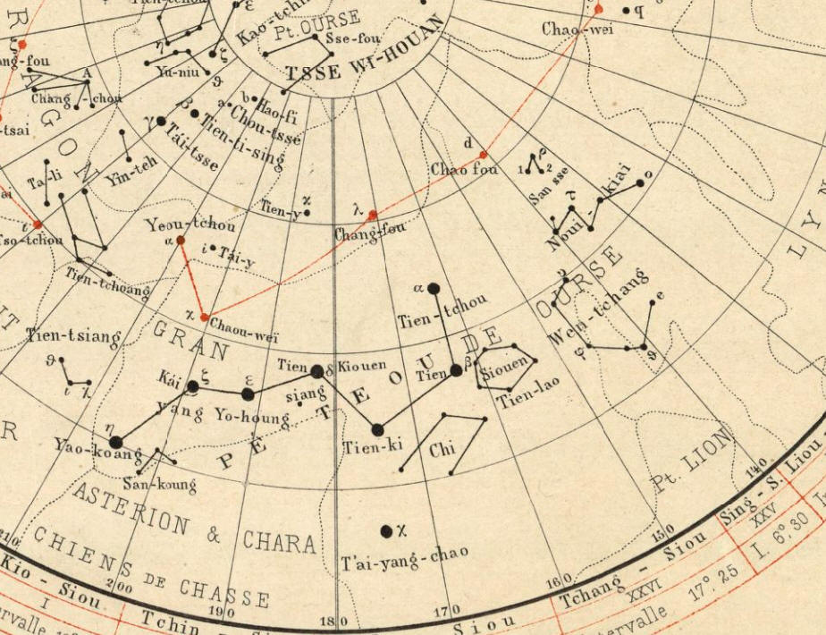
http://www.atlascoelestis.com/Schlegel%201875.htm
e
Jean-François Foucquet
Pro confirmatione systematis temporum propheticorum, hoc planispherium est in duplici, nempe in recto et in verso situ contemplandum. Hémisphère céleste boréal avec légende en chinois et annotations manuscrites en latin, Francia 1722 circa
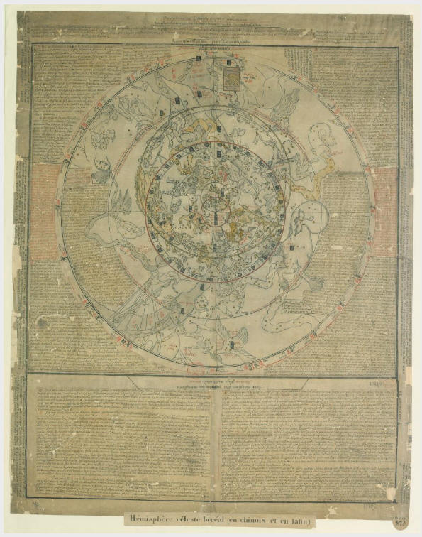
http://www.atlascoelestis.com/Foucquet%201822.htm
Nota conclusiva:
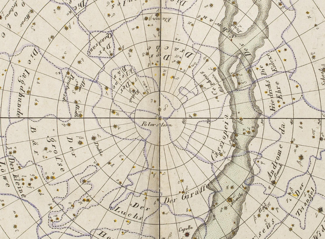
Per apprezzare lo spostamento delle stelle a seguito del fenomeno della precessione degli equinozi confronta la parte centrale della tavola cinese ( che di seguito ho opportunamente ruotata affinché il coluro equinoziale appaia esattamente da sinistra a destra) con una carta celeste del 1820: http://www.atlascoelestis.com/Fembo%201820.htm .
Tra le date di produzione delle due carte c'è una differenza di 630 anni, pari al 2,45% del ciclo completo di precessione degli equinozi di 25.720 anni, che equivale allo spostamento di 8,82° di tutte le stelle intorno al polo eclittico.
Lascio al lettore l'esercizio di identificare nelle due tavole la posizione del polo eclittico e di tracciare il cerchio intorno ad esso avente come raggio la distanza dal polo equatoriale (il centro delle due tavole). Il cerchio così prodotto è quello sul quale si sposta la proiezione del polo celeste equatoriale a causa del fenomeno della precessione degli equinozi. Identificare su tale cerchio della tavola celeste cinese la stella più vicina alla proiezione del polo equatoriale, identificare quindi, sempre sul perimetro delle stesso cerchio, la posizione della nostra Alfa Ursa Minoris e verificare se la distanza tra le due stelle sottende un angolo di 8,82°.

Sull'astronomia cinese, le costellazioni e la rappresentazione del cielo confrontati con il sistema occidentale puoi leggere:
Chrétien-Louis Joseph De Guignes
Planisphère céleste chinois. Partie Septentrionale. Paris 1785
Planisphère céleste chinois. Partie Meridionale, Paris 1785
in
Mèmoires de Mathematique et de Physique, Présentés a l'Académie Royal des Sciences, Par Divers Savans (Etrangers), Vol 10, Paris 1785
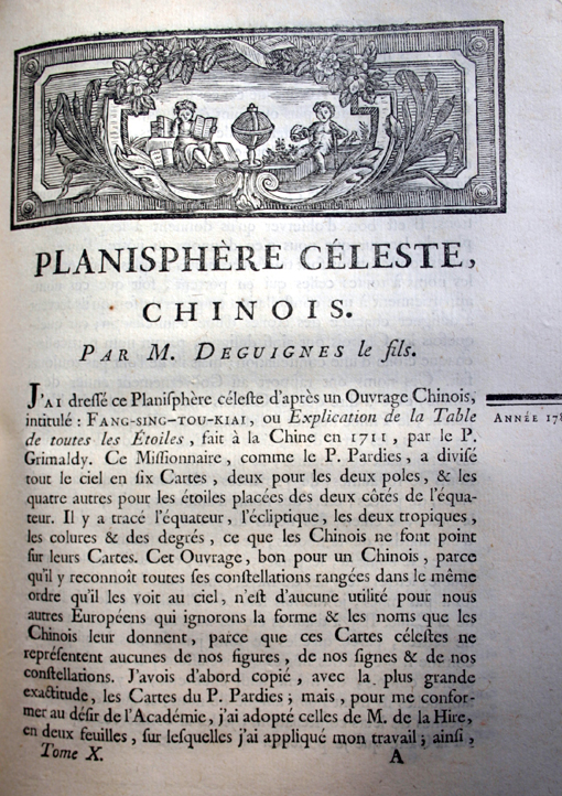
http://www.atlascoelestis.com/Deguignes%20home.htm
di FELICE STOPPA
FEBBRAIO 2019
