
|
George Minshull da Nicholas Lane e Richard Cushee
|
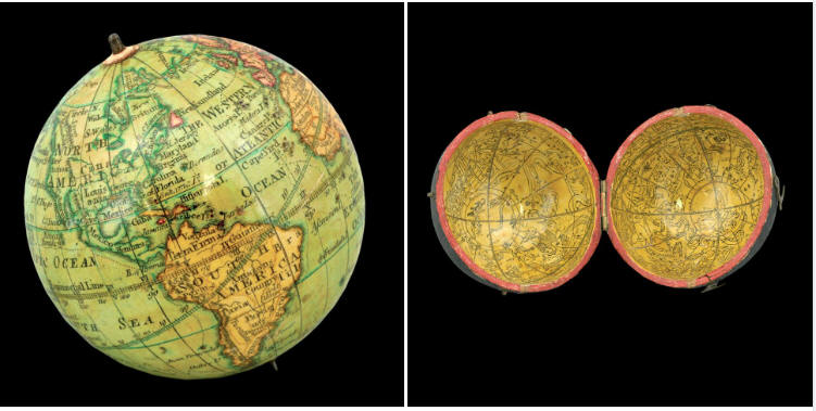
A toymaker’s globe, London 1816
|
George Minshull
da
Nicholas Lane e Richard Cushee
A toymaker’s globe, London 1816

Per cortesia di
https://www.crouchrarebooks.com/globes-and-planetaria/a-toymakers-globe
Physical description
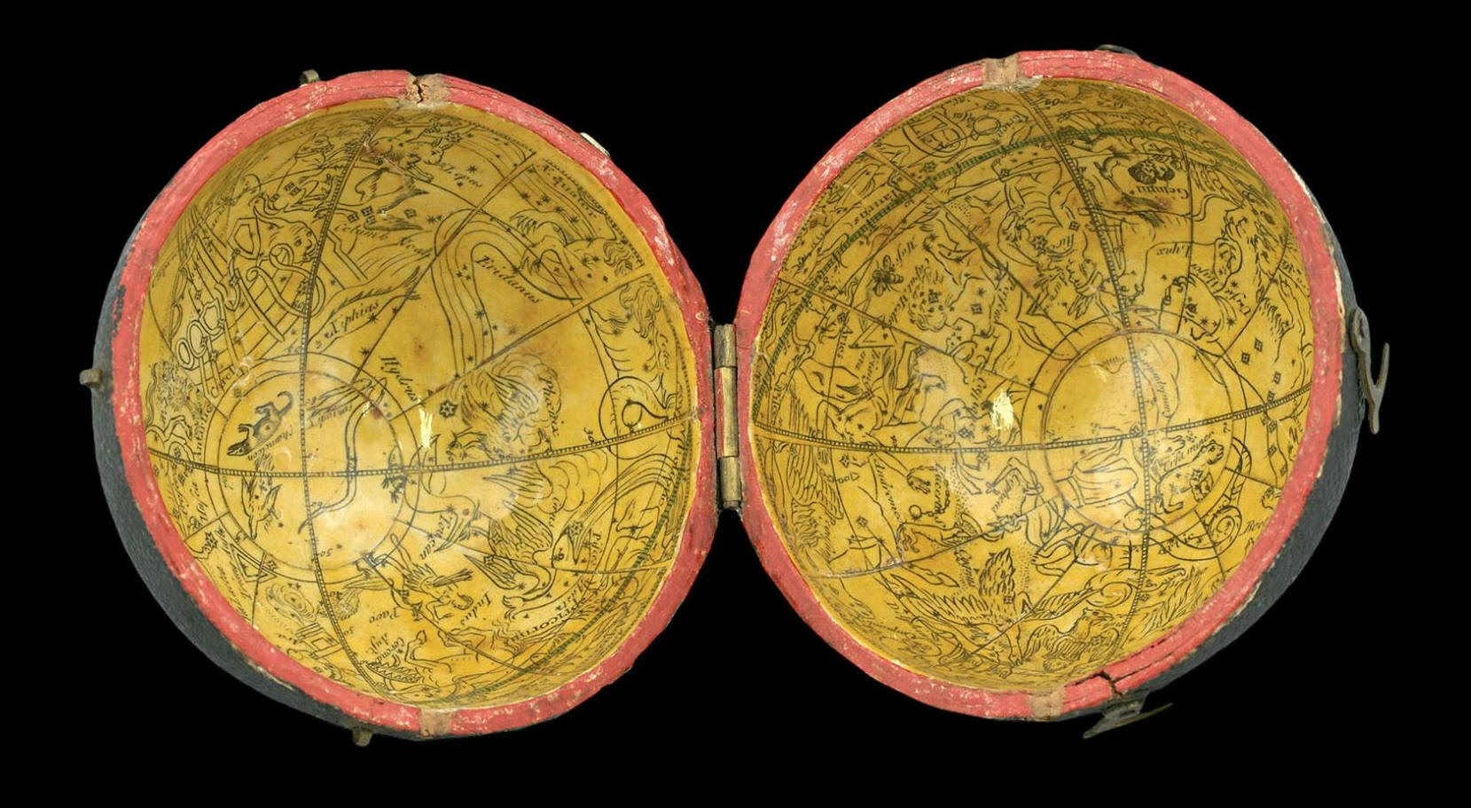
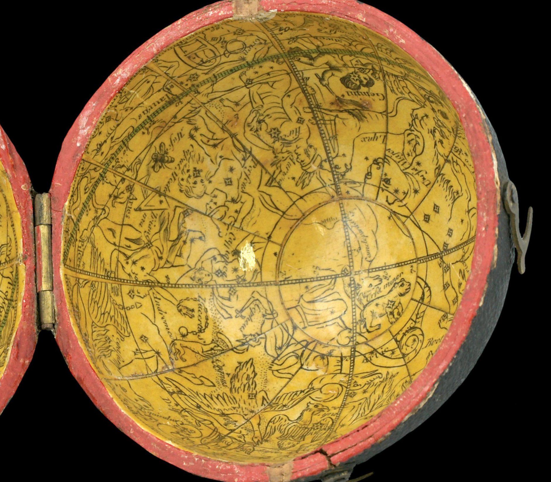
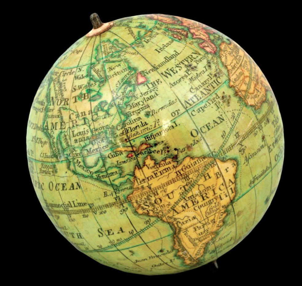
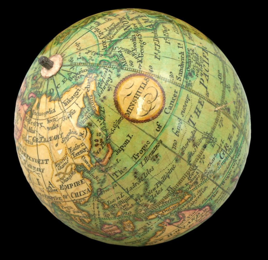
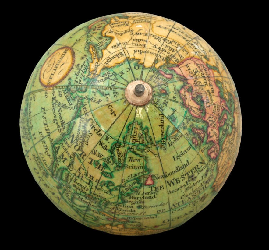
Globe, 12 hand-coloured engraved paper gores, clipped at 70 degrees latitude, with two polar calottes, over a papier mâché and plaster sphere, paste-over imprint to cartouche, varnished, housed in original shagreen over paste-board clamshell case, with hooks and eyes, lined with two sets of 12 hand-coloured engraved celestial gores. Diameter: 70mm (2.75 inches).
Biography
George Minshull (fl1800-1835) was a toymaker and carver. Although based in
Birmingham, there was a “George
Minshull & Son” registered in Hatton Garden in London in 1814, suggesting the
globe was sold there. It was common for small cartographic items and scientific
instruments to be sold alongside toys.
Geography
Minshull’s globe is an updated version of Thomas Lane’s issue of his father’s
pocket globe. Minshull was one of several makers who reissued Lane family globes
— his imprint has been pasted over the original. Nicholas Lane’s pocket globe,
with completely new terrestrial plates, was first issued in 1779. His son,
Thomas, updated the plates in 1807 and sold them wholesale. The present globe is
based on Thomas’s updated plates.
“New South Wales, Botany Bay and Cape Byron are depicted in New
Holland (Australia), and “Buenos
Ayres” (Buenos Aires) appears in South America. Two years later there were more
changes: Dimens Land (Tasmania) is separated from New Holland by the Bass Strait;
Port Jackson (Sydney) is added to the eastern coast of the mainland; and Sharks’
Bay and ‘South C.’ are newly marked on the western side. The Antipodes of
London are also shown. In northwest America, “New Albion” and the “Stony
Mountains” (the Rockies) have been added. Curiously, the date of Captain Cook’s
death, 14 February 1779, is another late addition squeezed in below the Sandwich
Islands” (Sumira).
By 1816, the date of the globe shown here, the geography has been altered yet
again: “At
the southern tip of the Californian peninsula, “C.
S. Lucas” (Cape San Lucas) is now shown… “Dampier’s
Anchor”, where William Dampier first reached Australia, is marked off the north
west coast of New Holland, and we see a mysterious “Labyrinth”
[The Great Barrier Reef] off the north-east coast” (Sumira).
Astronomy
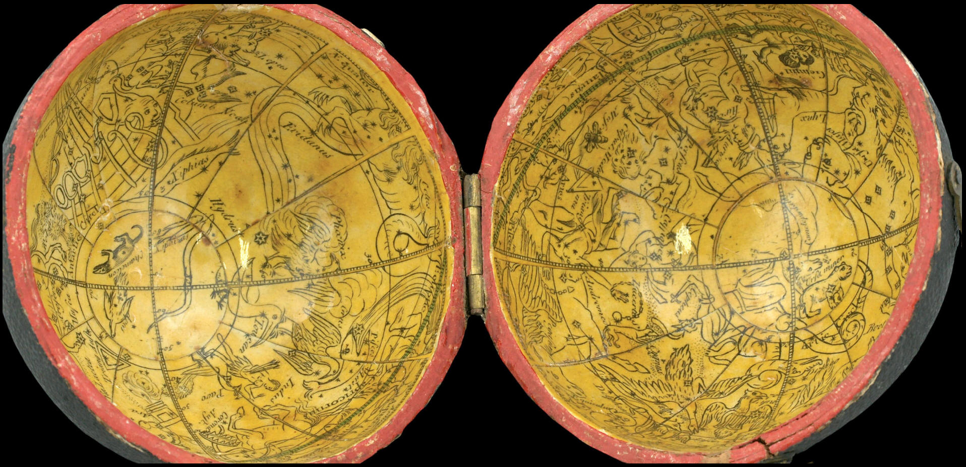
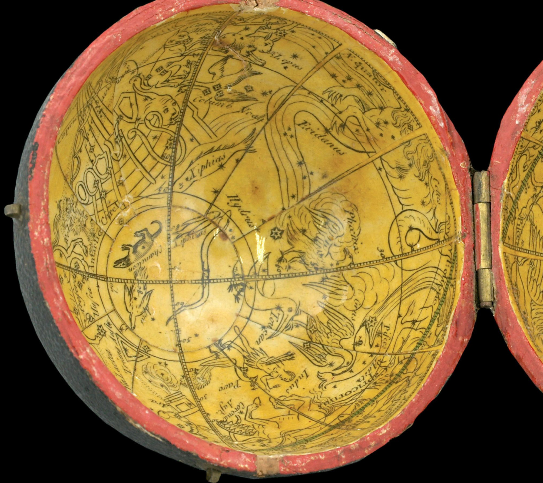
The celestial gores, which were acquired by Nicholas Lane from Richard Cushee sometime in the mid-eighteenth century, are geocentric in orientation. The difference is most noticeable in the orientation of Ursa Major, with the bear facing the other direction. The deep green colour is characteristic of Lane globes. Minshull has put his own stamp on the celestial gores by only colouring the constellations in green.
Bibliography
Dekker, pp.393–394
Dekker, Elly. (1999). Globes at Greenwich: A Catalogue of Globes and Armillery Spheres at the National Maritime Museum in Greenwich. Oxford: Oxford University Press and the National Maritime Museum.
Sumira 35 and 45
Sumira, Sylvia. (2014). The art and history of globes. London: The British Library.
Worms and Baynton-Williams, p.451.
Worms, L. and Baynton-Williams, A. (2011). British map engravers. London: Rare Book Society.
Il globo celeste
da
Richard Cushee
Il globo terrestre
da
Nicholas Lane

Di
Nicholas Lane
leggi anche
Pocket Globe, London 1808

http://www.atlascoelestis.com/Lane%201808.htm
di FELICE STOPPA
APRILE 2023
