|
Robert Woolsey |
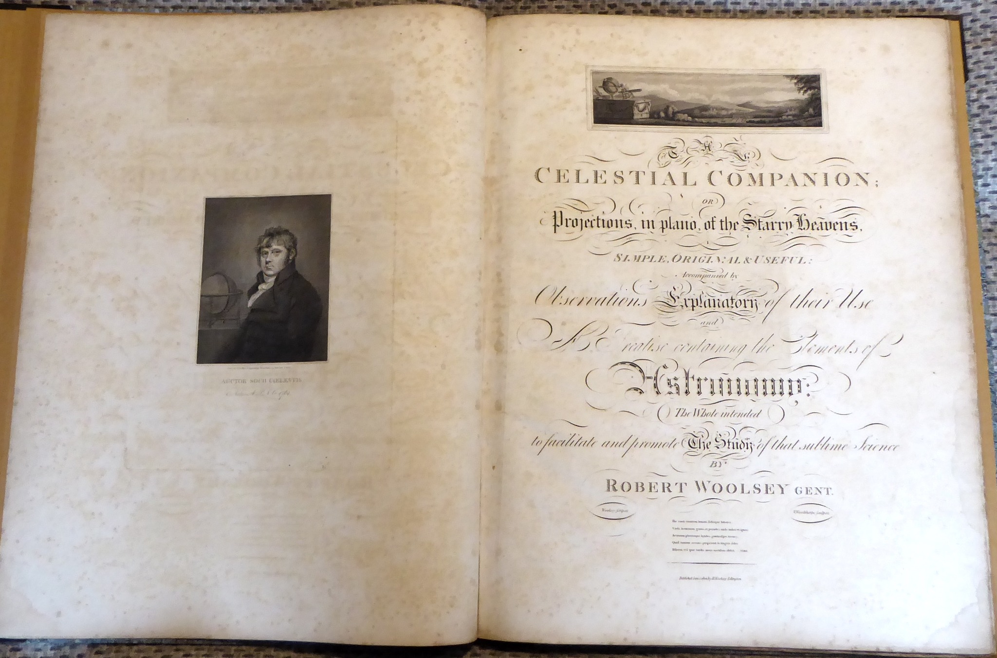
The Celestial Companion: or Projections, in Plano, of the Starry Heavens …, Islington-London 1802
|
Robert Woolsey
The Celestial Companion: or Projections, in Plano, of the Starry Heavens …, Islington-London 1802
Propongo di seguito il testo e le immagini della cartelletta di Robert Woolsey che Bob MCNaught ha presentato il 12 gennaio 2024 sulla pagina di Facebook del gruppo Wintage Astronomy Books.
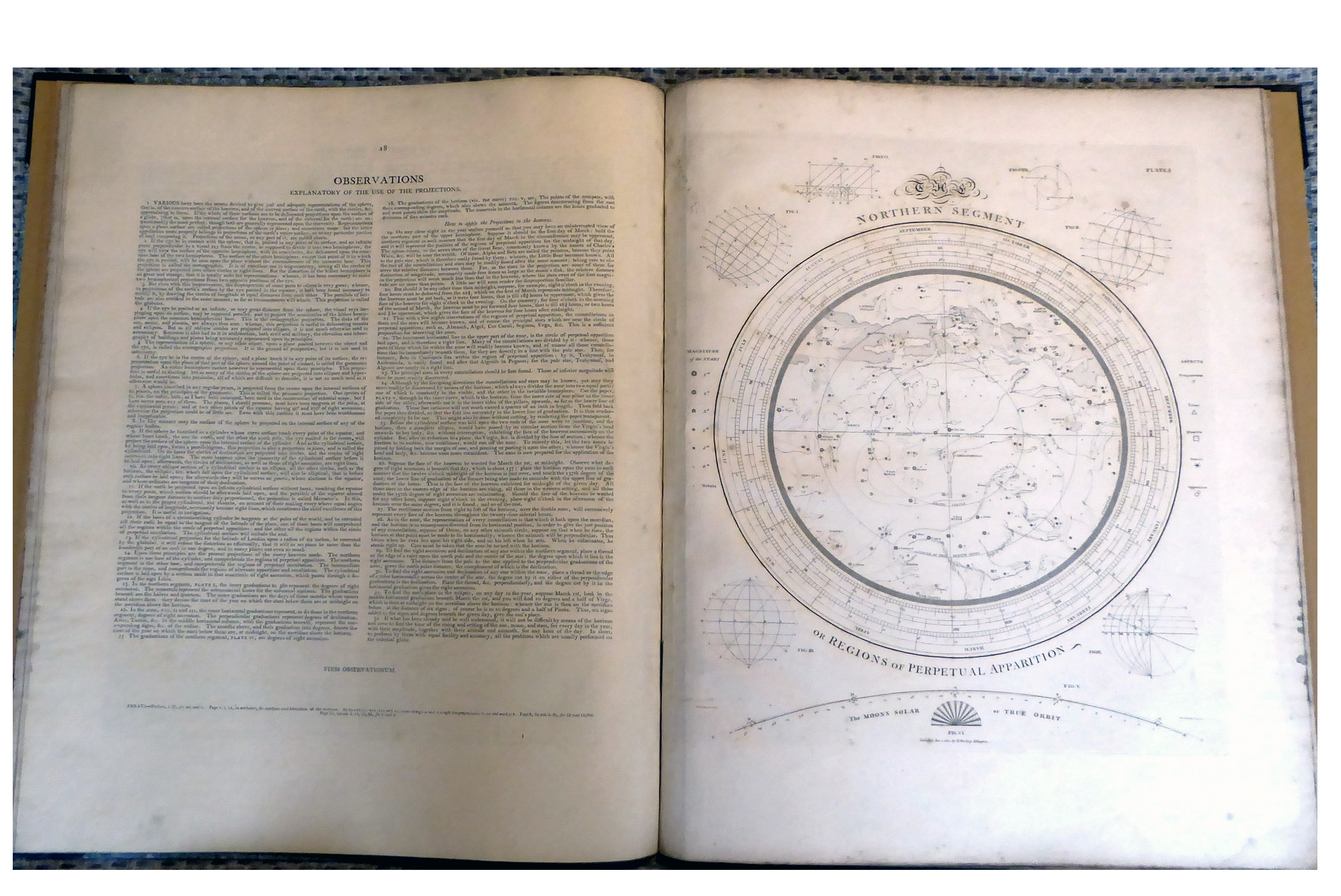
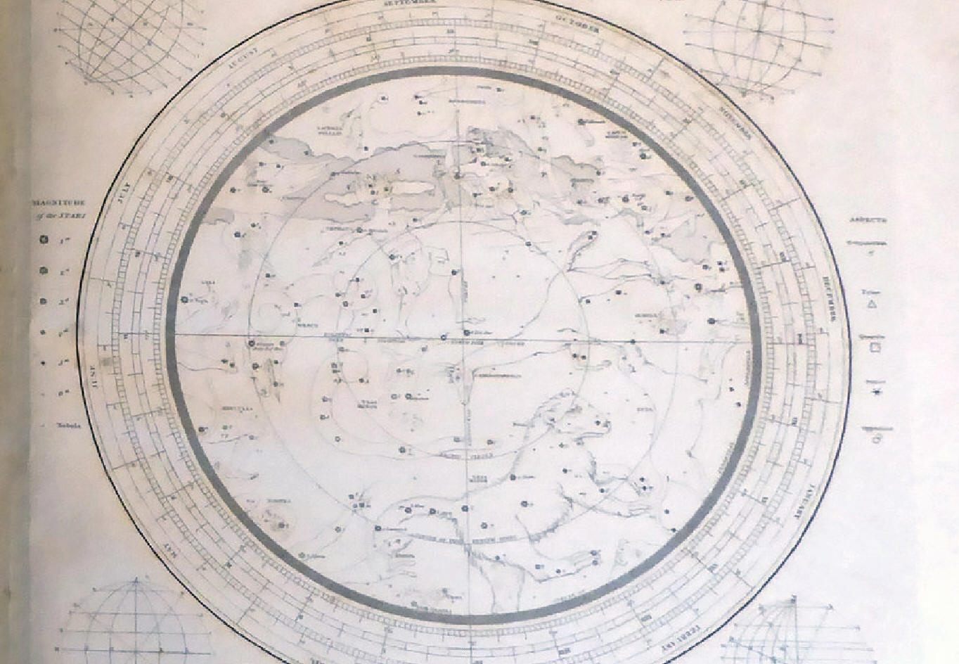
Nelle immagini che riporto do più rilievo alle due carte celesti, planisfero boreale limitato alle stelle sempre visibili da Londra e fascia equatoriale (dalla declinazione +40° a -40°), che rappresentano il cielo con le costellazioni di rilievo nel 1802.
"A Huge Georgian Work Containing a Do-It-Yourself 3D Instrument with (optional) Transparent Parts
The Celestial Companion: or Projections, in Plano, of the Starry Heavens by Robert Woolsey
London: R. Woolsey, Islington, 1802, elephant folio (16½ x 21½ inches (and cropped within the platemark)).
Finely engraved portrait frontispiece, elaborate engraved title with a vignette, five finely engraved astronomical plates (1 repeat), including three double-page.
This is one of my favourite works - it's astonishing really - displaying the boundless enthusiasms of Mr. Woolsey and his eager attempts to display the heavens to everyone. Self-published but at the great expense of a Mr. Wright it seems. I find the oversized format coupled with the tiny font strange - maybe that's a conceit of the day - but the whole thing is tremendous and has to be stored in a cupboard.
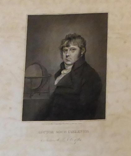
"Woolsey, Robert, an attorney in London, who for some time kept an academy near Hampstead, but failing in that line, returned again to the law. He was patronized by the late George Wright, who was at the expense of publishing a showy work by him, exhibiting on plates a view of the heavens…" - A Biographical Dictionary of the Living Authors of Great Britain and Ireland.
The instrument within is exceptional I think, and I could find no information regarding it. The work is quite uncommon with 3 copies recorded in the UK (2 in the BL), and 5 elsewhere.
The instructions are quite vague (see image of instructions starting at paragraph 24) but this is what I think they mean:
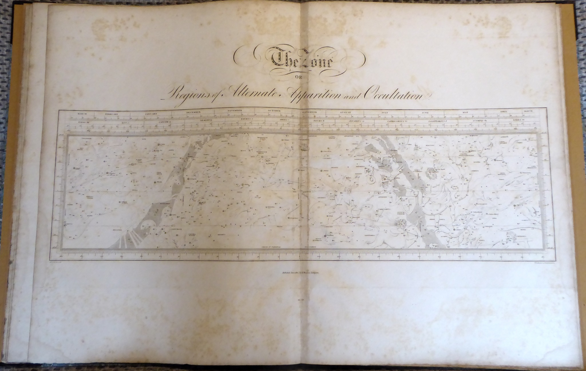
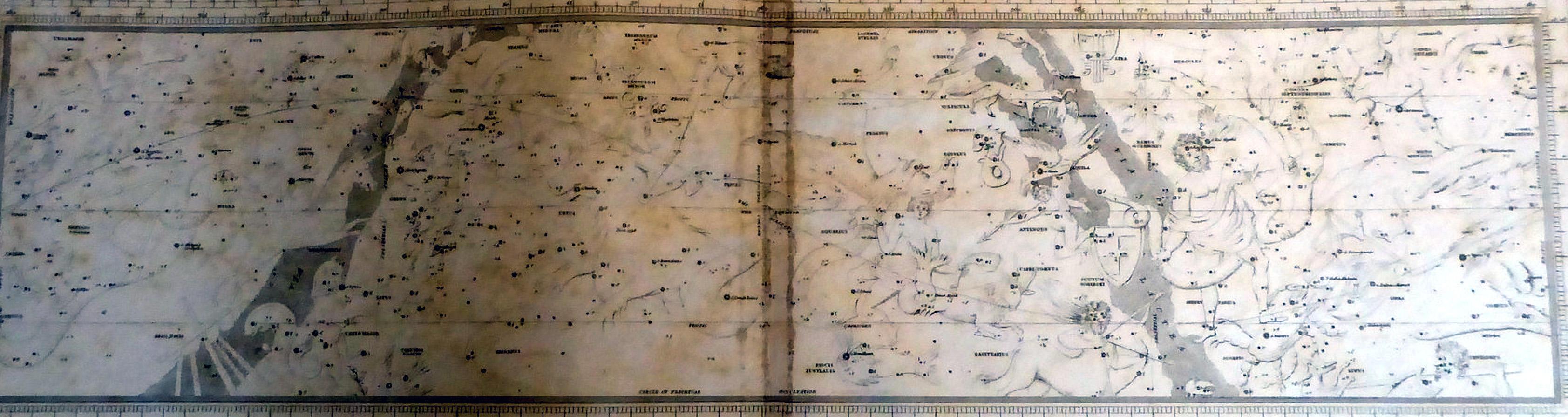
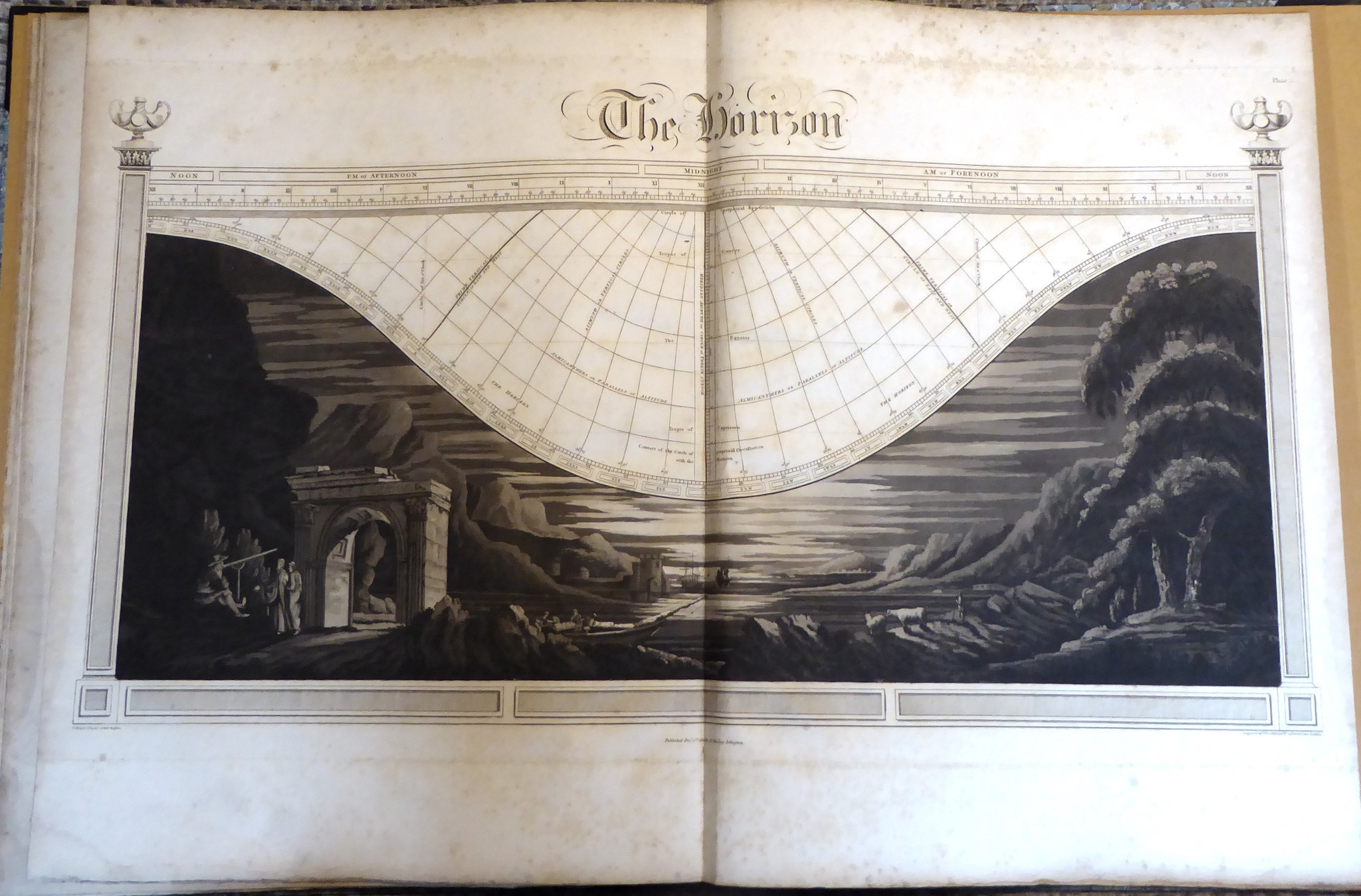
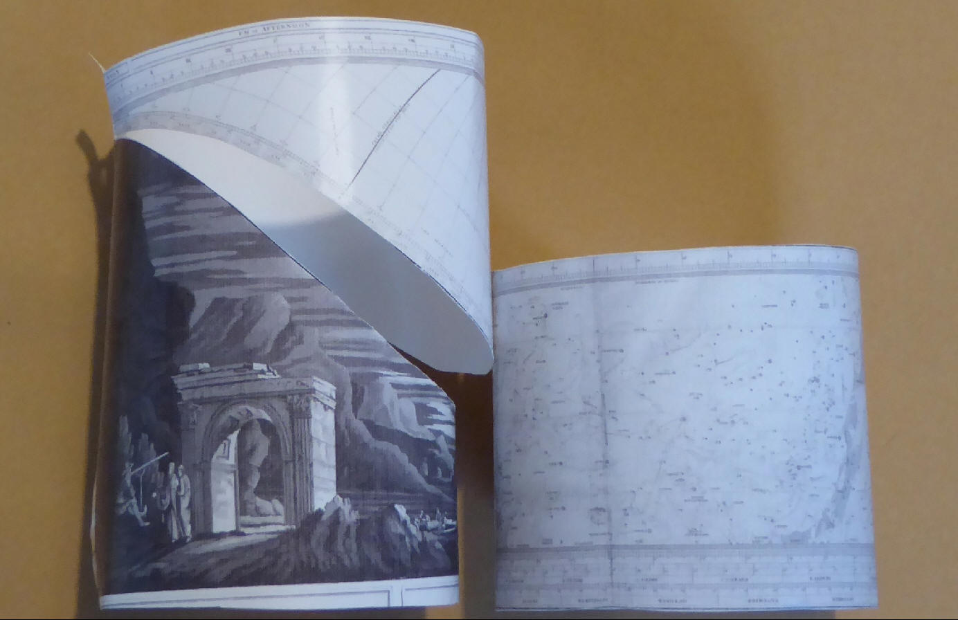
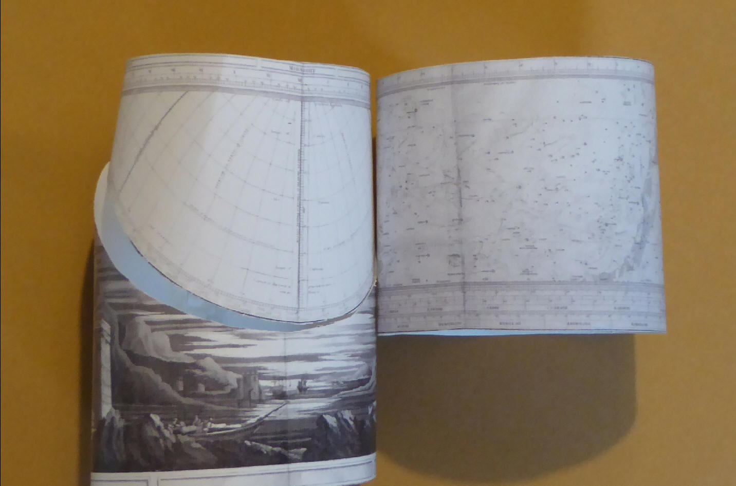
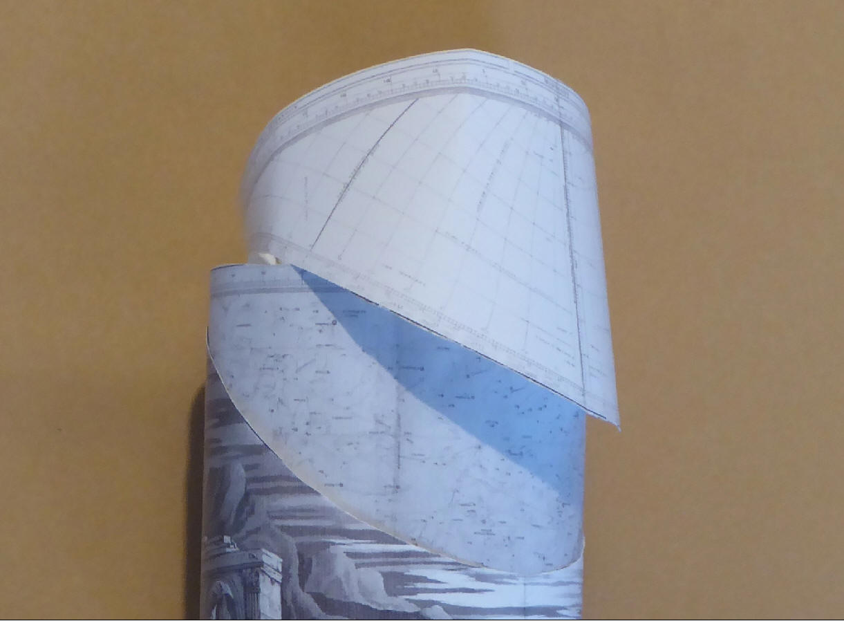
The Zone Plate containing the equatorial star map should be extracted, trimmed, and glued into a cylinder, stars facing out. The Horizon, or Scenery, Plate is extracted, trimmed, and cut* to allow the central part to fold away, leaving the horizon free. I think the Horizon Plate should be formed into a cylinder and the Zone Plate inserted within. Rotating the Zone Plate correctly thus shows which constellations are visible at the time and date desired.
There are 2 copies of the Zone Plate so one can be extracted and used as the instrument leaving the other for normal mapping purposes.
The Northern and Southern planispheres fit onto the end of the cylinder so one can see what orientation those stars are in too - those near the back of the Horizon Plate are on the horizon in reality (due north). Woolsey does not suggest this but it would all fit, I think.
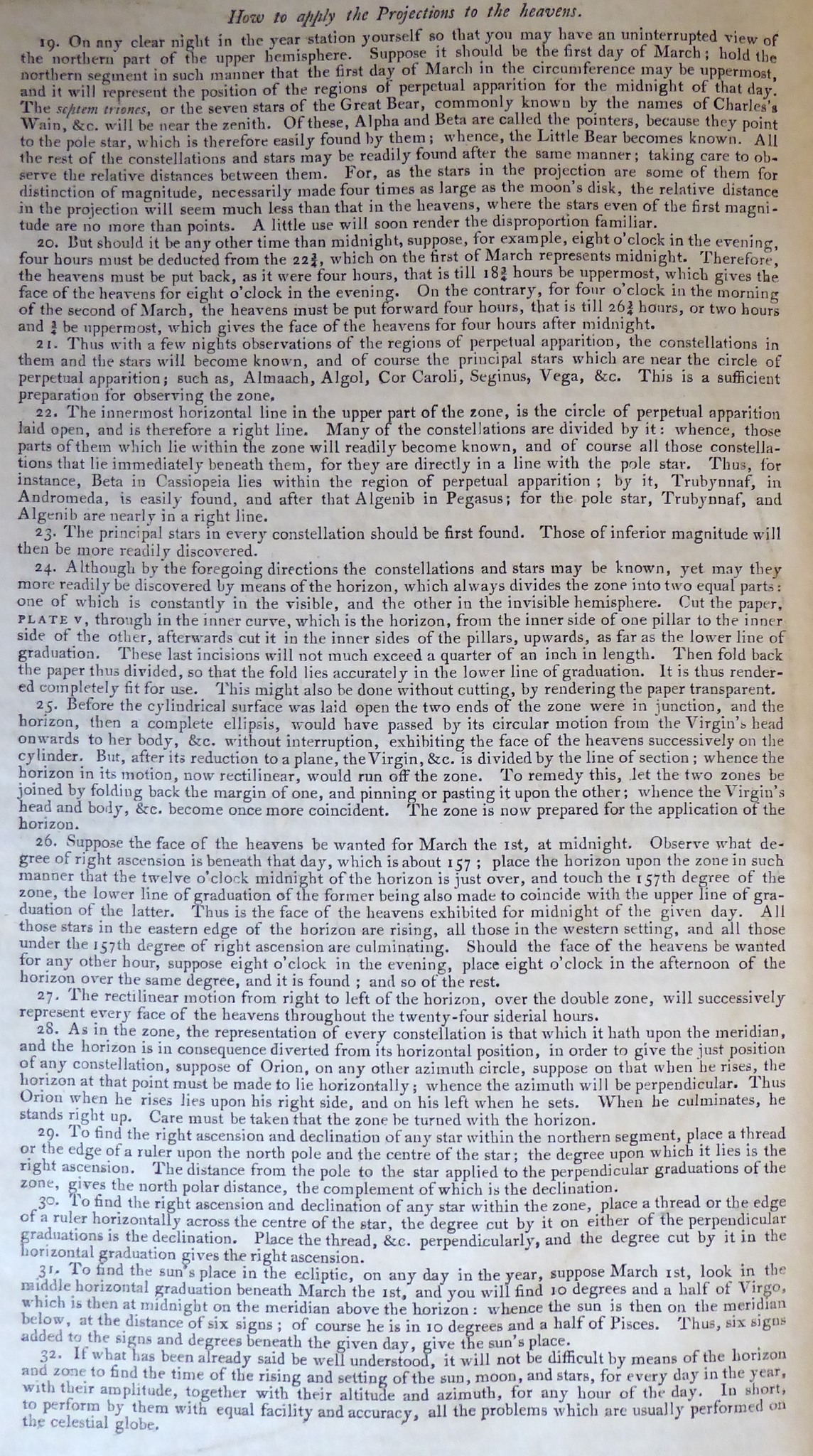
See the photos of my smashing, ...er nice, ...er terrible really, scale model.
*Note that here, instead of cutting, Woolsey suggests that the Coordinate Area can be rendered transparent (by rubbing with oil) to overlay the Zone Plate. Here, a transparent Coordinate Area would show both the coordinates and the constellations at the same time. Amazing!"
di FELICE STOPPA
OTTOBRE 2024
